Terms of Reference (Extension)
|
Title |
Development of a Digital Geo-Referenced Database and Mapping System for Shrimp Production Areas under the MACIB Project |
|
Client |
Toan Thang, Hoa Nho, Hoa De in Can Tho; Tai Thinh Phat Farm and Tan Phat Loi in Ca Mau |
|
Country |
Vietnam |
|
Project number |
24ATVN-9764 |
|
Assignment number |
|
|
Period |
Mar – May 2026 |
|
Cooperative advisors (CAs) |
Le Thi Thu Hien, Nguyen Thanh Trang, Tran Quang Dieu |
1. BACKGROUND
The Making Aquaculture Cooperatives in the Mekong Delta Inclusive and Bankable (MACIB) project, funded by the Dutch Ministry of Foreign Affairs and implemented by Agriterra, is a two-year initiative supporting the transformation of shrimp cooperatives in the Mekong River Delta (MRD) into inclusive, professional, and market-oriented entities. The MRD accounts for over 80% of Vietnam’s shrimp export volume, but the sector remains dominated by fragmented smallholder systems that lack the infrastructure, data systems, and collective planning capacity needed to meet emerging sustainability and market demands.
MACIB’s baseline and midterm assessments have highlighted critical bottlenecks to cooperative growth and certification readiness, particularly the absence of reliable, geo-referenced data on shrimp production areas. Key gaps include:
- Unclear farm boundaries and pond areas at member level;
- Lack of spatial zoning by farming model (intensive, semi-intensive, extensive/mangrove);
- Missing link between land/pond ownership and production data;
- No centralized mapping system to support traceability, certification planning, or market aggregation.
These gaps not only undermine the cooperatives’ ability to comply with international certification schemes (e.g. ASC, Organic, VietGAP) but also weaken their position in B2B negotiations with buyers that increasingly demand verified, sustainable sourcing.
MACIB is promoting the “clustered cooperative” approach as a pathway for structural transformation, combining farmer-owned ponds into traceable, water-smart zones with shared infrastructure and aligned production systems. To operationalize this model, cooperatives must have access to an accurate digital spatial database that links production assets (land, ponds, infrastructure) with farmer identity and sustainability criteria.
This assignment is a strategic intervention under MACIB to build the digital foundation necessary for:
- Certification planning and zoning (ASC/Organic clusters),
- Traceability system deployment (QR code, blockchain-ready),
- Bankable investment plans based on mapped infrastructure needs,
- Direct linkage with international buyers seeking certified supply.
Ultimately, this work will position the targeted cooperatives as credible, certified suppliers in high-value markets, while improving environmental accountability and enabling long-term growth through data-driven decision-making.
2. OBJECTIVES
The main objective of this assignment is to:
Design, develop, and operationalize a high-quality, geo-referenced digital database and mapping system for shrimp production areas under selected MACIB cooperatives, capturing land, water, pond infrastructure, and farming models using GPS and farmer-linked data, with the aim to:
- Enable certification planning (ASC, Organic, CoC) at cooperative or cluster level;
- Support digital traceability systems and verified sourcing solutions for buyers;
- Facilitate investment planning for shared infrastructure and zone-based water management;
- Strengthen the cooperatives’ ability to act as bankable and data-driven producer organizations;
- Provide buyers, certifiers, and authorities with a trusted spatial reference to engage with cooperative-based shrimp supply in the MRD.
This work will generate long-term value across all MACIB workstreams, including governance, finance, sustainability, and market linkages, and will serve as a blueprint for broader scaling across the Delta.
3. SCOPE OF WORK
The selected consultant or service provider will be responsible for the end-to-end design and development of a digital geo-database and GIS-based mapping system for shrimp production areas under cooperatives supported by the MACIB Project. The work must result in a functional, user-friendly, and certifier-ready spatial data system that supports traceability, sustainability certification, and strategic buyer engagement.
The scope includes the following key workstreams:
3.1. Inception and Planning
- Review MACIB project documents, cooperative baseline datasets, MTR recommendations, and specific cooperative needs.
- Develop a clear implementation plan and data collection framework tailored to MACIB’s shrimp cooperative clusters in Can Tho and Ca Mau (see concrete address in annex 1)
- Design a GIS mapping methodology that includes household-level geo-tagging, pond mapping, infrastructure data capture, and farming model classification.
- Develop consent and data protection protocols in alignment with MACIB’s ethical standards and farmer data ownership principles.
3.2. Field Data Collection
- Conduct on-site GPS data collection across all targeted shrimp production areas managed by cooperative members.
- Land boundaries and farm blocks (GPS-based)
- Pond locations, sizes, shapes, and use (by crop cycle)
- Farming system classification (e.g. intensive, semi-intensive, mangrove-integrated)
- Supporting infrastructure (e.g. water canals, sediment ponds, mangrove buffer, aerators)
- Farmer identity and cooperative membership linkage
- Engage with cooperative leaders and members to validate collected data and fill in missing attributes.
3.3. Digital Database Design and Population
- Build a centralized, scalable digital database (MS Excel/Access, PostgreSQL, or other compatible formats) with the following minimum fields:
- Member name, ID, contact
- Pond ID, area, GPS coordinates
- Farming system type
- Number of crops/year
- Current certification status (if any)
- Environmental features (e.g. mangrove cover, water source type)
- Infrastructure assets (e.g. solar dryer, waste ponds, biosecurity gates)
- Ensure data compatibility with traceability and certification platforms (e.g. ASC Dashboard, Control Union systems, blockchain).
3.4. GIS Mapping and Visualization
- Develop high-resolution digital maps for each cooperative showing:
- Pond distribution by farming model
- Clustering opportunities for certification or traceability zoning
- Infrastructure layout and shared resources
- Water source/discharge pathways and risk areas (e.g., salinity, flood)
- Deliver:
- Static printable maps for each cooperative
- Web-based or open-source GIS layer for cooperative and MACIB use
- Metadata documentation for each map
3.5. Capacity Building and Handover
- Train selected cooperative focal points and Agriterra staff on:
- Basic GIS concepts and map interpretation
- How to maintain and update digital records
- Use of handheld GPS/mobile apps for future expansion
- Deliver a step-by-step manual and SOPs for database usage and updates
- Conduct joint validation workshops with cooperatives and local authorities to review and finalize outputs
3.6. Reporting and Recommendations
- Prepare and submit a comprehensive final report including:
- Methodology and tools used
- Summary of findings and analysis
- Cooperative-level maps and datasets
- Recommendations for:
- Integration into certification roadmap (e.g. ASC/Organic zoning)
- Linkage to digital traceability systems and buyer platforms
- Future data governance and expansion strategy
4. DEVILERABLES
4.1. Inception Report
- Detailed methodology, workplan, cooperative engagement strategy, and data collection tools (GPS protocols, survey forms, etc.)
- Risk assessment and data privacy plan
- Timeline and roles/responsibility matrix
4.2. Raw and Cleaned Geo-Data Files
- Complete set of GPS-tagged production data for all shrimp farming households in the selected cooperatives
- Datasets to include: member IDs, pond coordinates and areas, farming model classification, and relevant attributes
- File format: CSV/Excel + GIS-compatible shapefiles (e.g. .shp or .geojson)
4.3. Centralized Digital Database
- Functional, consolidated digital database structured for cooperative and Agriterra use
- Fully populated with verified production, land, pond, and infrastructure data
- Format: Excel or PostgreSQL/Access (to be discussed); with documentation and data dictionary
4.4. GIS Maps and Visualizations
- Static printable maps (PDF/PNG) for each cooperative, showing:
- Member-level shrimp pond layout
- Farming model zones (e.g., ASC/organic eligibility clusters)
- Infrastructure overlay and water flow mapping
- Dynamic GIS map files (layered shapefiles or QGIS project files)
- Optional: Web-map version if feasible (open-source or embedded in cooperative’s digital profile)
4.5. Capacity Building Materials
- One half-day training session for each participating cooperative on:
- Map interpretation
- Basic GPS usage
- Database maintenance and updates
- Training materials: Slides, SOP/manual (English and Vietnamese), sign-in sheet
4.6. Final Technical Report
- Executive summary
- Methodology and tools
- Data analysis summary (e.g., total area by farming model, cluster mapping for certification)
- Lessons learned and challenges
- Practical recommendations for:
- ASC/organic zoning and traceability platform integration
- Scaling approach for remaining MACIB or national cooperatives
- Annexes: All raw data, shapefiles, maps, photos
Due: 10 Jun 2026
5. TIMELINE
- Expected Start Date: 30 Mar 2026
- Expected Completion Date: 31 May 2026
The assignment will be implemented in sequential phases:
|
Phase |
Key Activities |
Indicative Timeframe |
|
Phase 1: Inception |
Kick-off, methodology finalization, stakeholder consultations |
|
|
Phase 2: Field Data Collection |
GPS mapping of ponds, infrastructure, and farming systems across cooperatives |
|
|
Phase 3: Data Processing |
Database development, verification, GIS mapping, visualization |
|
|
Phase 4: Capacity Building |
Training sessions and cooperative-level validation workshops |
|
|
Phase 5: Finalization |
Final report, digital handover, and recommendations |
|
The specific dates can be adjusted based on the consultant’s availability and MACIB’s schedule, with agreement from Agriterra Vietnam.
6. REQUIRED QUALIFICATIONS
The selected consultant (individual or organization) is expected to possess the following qualifications and competencies:
- Proven experience in GIS mapping, GPS-based data collection, and spatial database development, particularly in rural/agricultural contexts;
- Demonstrated understanding of aquaculture production systems, with a preference for experience in shrimp farming models (intensive, semi-intensive, mangrove-integrated);
- Experience working with cooperatives, farmer groups, or B2B agriculture/aquaculture platforms;
- Familiarity with certification standards (e.g., ASC, Organic, VietGAP, Chain of Custody) and traceability solutions (e.g., QR code, blockchain, digital dashboards) is a strong advantage;
- Capacity to produce high-quality maps and databases in both technical and user-friendly formats;
- Strong interpersonal and communication skills, including the ability to train and coach non-technical users, such as cooperative managers or farmer representatives;
- Ability to work independently while coordinating with multiple stakeholders, including local authorities, private sector partners, and NGOs.
7. MANAGEMENT AND CORDINATIONS
- The consultant will report directly to Agriterra Vietnam’s MACIB Project Team, under the supervision of the Senior Agribusiness Advisor and in close collaboration with relevant project advisors and cooperative support teams.
- The assignment will involve regular coordination with cooperative board members, data focal points, and local extension officers, especially during the field data collection and validation phases.
- Agriterra will provide:
-
- Letters of introduction to cooperatives and local stakeholders
- Technical briefings and existing datasets from MACIB assessments
- Logistical and advisory support for training activities and validation workshops
- All deliverables must be submitted in English (with key training materials in Vietnamese) and will be reviewed and approved by Agriterra prior to final acceptance.
8. APPLICATION AND SELECTION PROCESS
Interested consultants or consulting teams are invited to submit a complete application package that demonstrates their capacity and suitability for delivering this assignment on Development of a Digital Geo-Referenced Database and Mapping System for Shrimp Production Areas under the MACIB Project.
Application Package Requirements:
- Cover Letter: Indicating the applicant’s interest in the assignment, highlighting relevant qualifications and experience, and outlining suitability for the role.
- Technical Proposal: Presenting the proposed methodology, tools, and work plan for implementing the tasks and deliverables outlined in this ToR, including an indicative timeline and consultant availability.
- Financial Proposal: Including the daily rate in VND (inclusive of taxes) with a detailed breakdown of estimated costs.
- Updated CV(s): Providing detailed qualifications and professional experience of the consultant(s), with at least two references. Examples of similar assignments in GIS mapping, spatial database development, and aquaculture/agriculture value chains should be attached.
Submission Guidelines:
- All application documents must be submitted in English.
- Please submit the full application package by email with the subject line:
“Consultant – Digital Geo-Referenced Database & Mapping System for Shrimp Production Areas (MACIB Project)” - Email submissions should be sent to: [email protected]
Selection Process:
- Only shortlisted candidates will be contacted and invited for an interview.
- The closing date for applications is 5pm 19 March 2026
Agriterra, for cooperatives
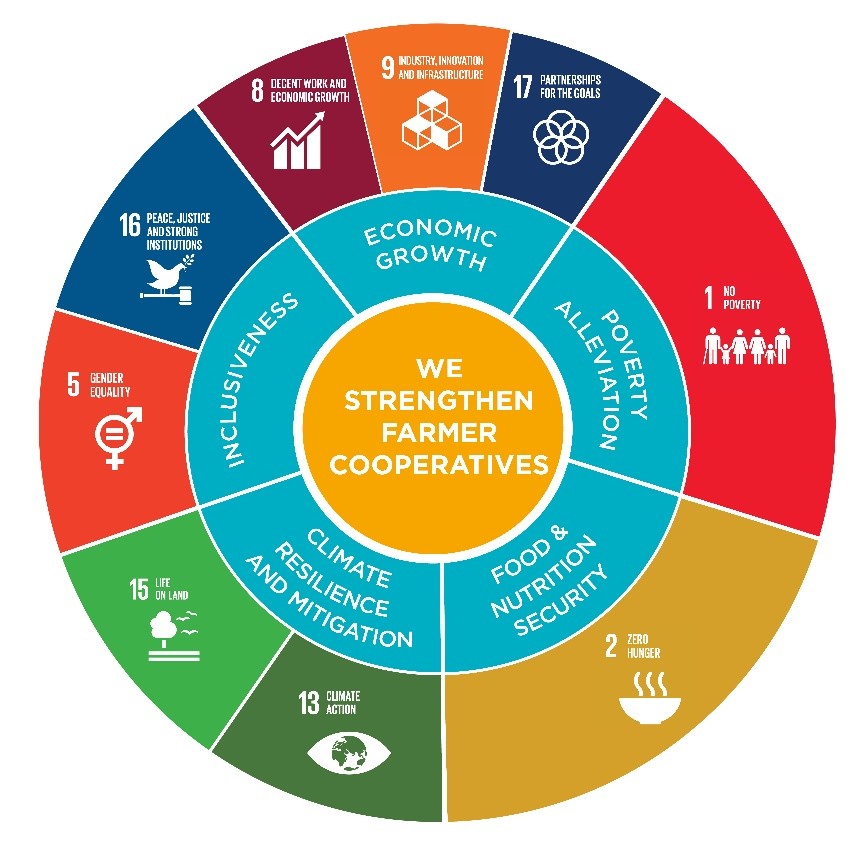
We are a purpose-driven organisation, aimed at strengthening farmer cooperatives in 13 countries in Africa and Asia. Agriterra’s wheel of impact depicts how strong farmer cooperatives contribute to societal development and the relevance to many of the Sustainable Development Goals of the United Nations.
Positively impacting farmer cooperatives is at the heart of our identity and is reflected in our legal entity as a Dutch non-profit foundation.
Agriterra provides high quality and hands-on advice, training and exchange services to farmer cooperatives with maximum impact to support dynamic, economic and sustainably strong and productive rural areas. We draw on a century of cooperative knowledge in the Netherlands shared through our extensive network in the Dutch agri-food sector. These Agripool experts from farmer organisations across the world work with Cooperative advisors from our country offices, supported by staff teams in the Netherlands.
In 2022 Agriterra worked together with 579 farmer organisations, trained 8,989 people and 3,808,366 farmers were reached.
ANNEX 1
|
Name of cooperatives |
New Address (old address) |
Number of members |
|
Toan Thang |
Khanh Hoa commune, Can Tho (Kinh Moi village, Vinh Hiep commune, Vinh Chau town, Soc Trang) |
80 |
|
Nong Ngu 14/10, Hoa Nho village |
Hoa Tu commune, Can Tho (Hoa Nho A village, Hoa Tu 2 commune, My Xuyen district, Soc Trang) |
29 |
|
Nong Ngu Hoa De |
Hoa Tu commune, Can Tho (Hoa De village, Hoa Tu 1 commune, My Xuyen district, Soc Trang) |
53 |
|
Tan Phat Loi |
Tan An commune (Tan An Tay commune, Ngoc Hien district) |
81 |
|
Tai Thinh Phat Farm |
Tam Giang commune (Tam Giang commune, Nam Can district) |
300 |